History
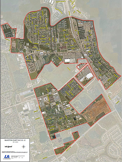
Galveston County Water Control & Improvement District No. 12 (the “District”), a political subdivision of the State of Texas, created by an order of the Texas Board of Water Engineers, a predecessor to the Texas Commission on Environmental Quality (the “TCEQ”), dated June 11, 1951, is located in the extreme northeast portion of Galveston County, approximately seven miles from Interstate Highway 45, the main traffic artery between the Cities of Houston and Galveston and the Counties of Galveston and Harris. It is bounded on the north by Clear Creek (the boundary line between Galveston and Harris Counties); on the west by the eastern city limits of League City; on the south by the southern city limits of the City of Kemah; and on the east by Galveston Bay.
The original District consisted of 355 acres of land and operated pursuant to the provisions of Article XVI, Section 59 of the Texas Constitution and Chapter 51 of the Texas Water Code. Through various annexations, the District now consists of approximately 1,219 acres of land which includes all or a portion of the incorporated Cities of Kemah and Clear Lake Shores, as well as various unincorporated areas. The District serves all the communities within its boundary, except approximately 55 lots and small tracts in Kemah Oaks and Jarboe Additions. On August 2, 1984, the District was converted to a municipal utility district operating under the provisions of Article XVI, Section 59 of the Texas Constitution and Chapters 49 and 54 of the Texas Water Code
District Map